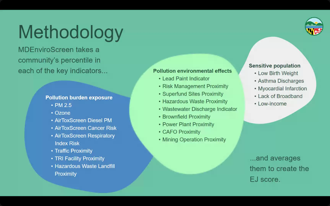
The Gunpowder RIVERKEEPER staff attended the webinar on Thursday, September 25th to gain an understanding of how the Maryland Department of the Environment’s updated Enviroscreen tool can help us analyze community data. The tool allows for an easy comparison between the demographics as provided by census data and the Environmental Justice (EJ) score as defined as percentiles of several environmental issues.
The tool allows for easy comparison of the EJ score to demographics of a search area, indicated by its status as “Underserved, “Overburdened,” both, or neither. Underserved communities are those with large percentages of residents who are of low income, who identify as non-white, or who have limited English proficency. Overburdened communities are those with a higher pollution burden exposure. Sliding the divider over the map allows the user to see the correlation between the demographics of an area and its EJ score.

The Environmental Justice score is also used to inform and calculate the related Climate Vulnerability Score (CVS). This score also takes into consideration the coverage of an area’s tree canopy and potential for urban heat islands, storm surge, drought, and flooding.
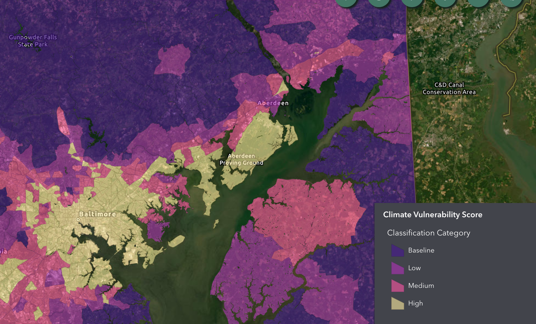
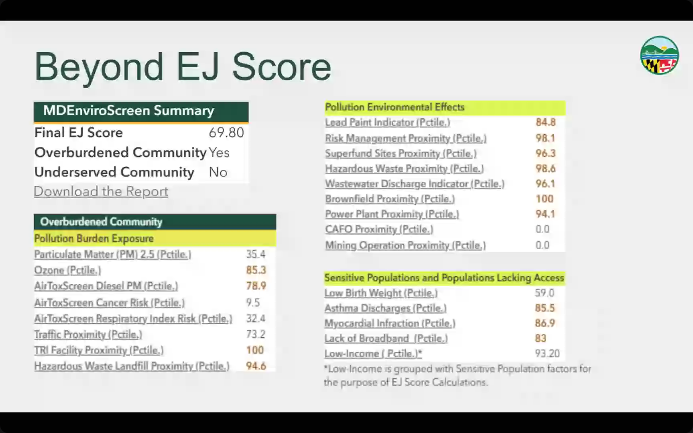
Although these individual maps are informative in their own right, the Enviroscreen tool overlay allows for the user to easily view the correlation between the two datasets and their various designations. Users can also find specific census data for a location to download in .PDF form.
Gunpowder RIVERKEEPER hopes to incorporate these maps into our other analysis of the Gunpowder watershed to provide equity for those communities which will be most affected by the ever changing climate.
An additional webinar will be hosted for interested parties on Tuesday September 30th, and any questions about the tool or environmental justice issues can be sent to ej.mde@maryland.gov.