

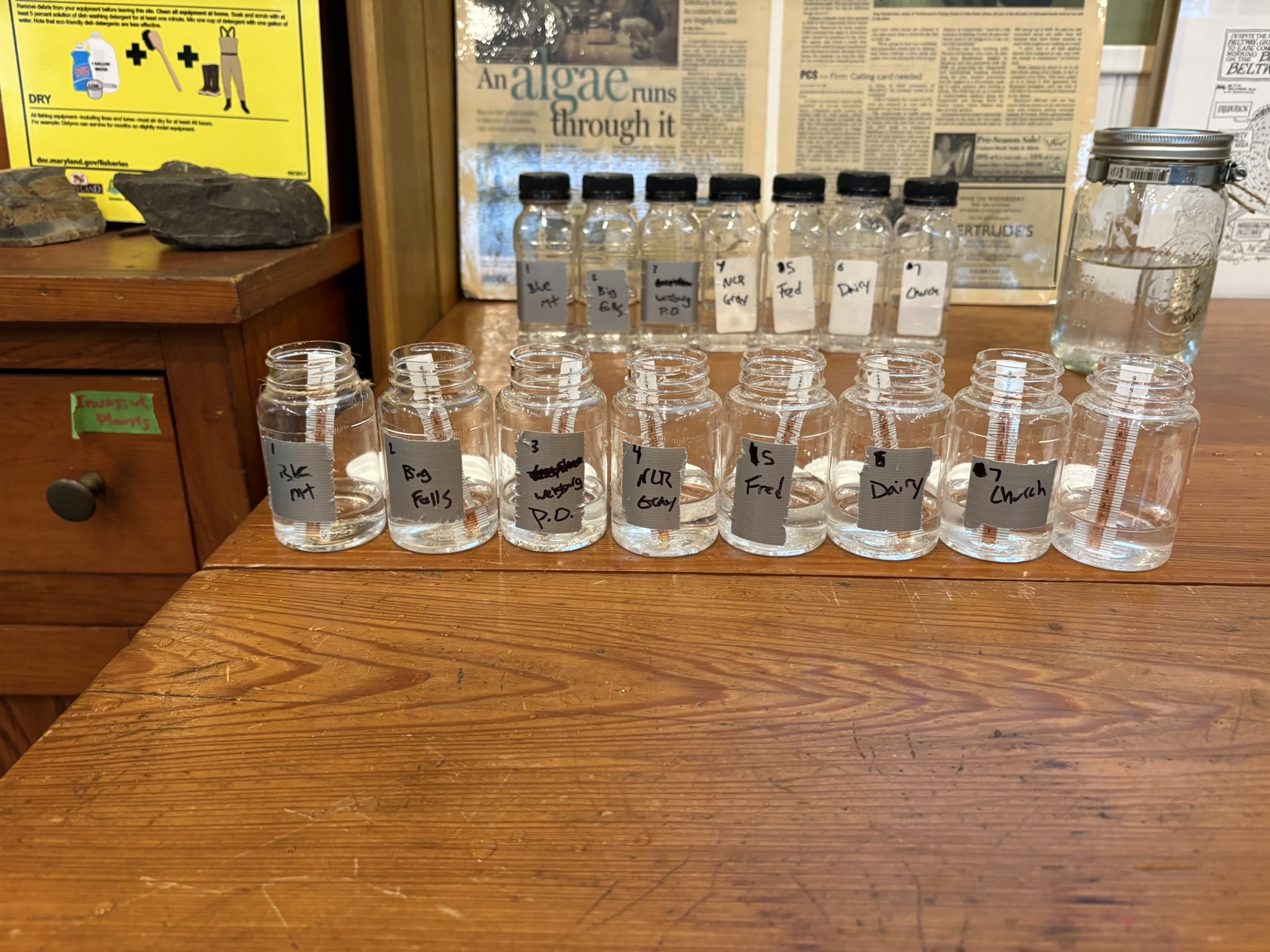
On Saturday January 10th, 2026 the skies above were dark and the ground wet from last night’s rain meaning its the perfect time to pack up our equipment and hit the road to sample for road salts in the Little Falls, a tributary of the Big Gunpowder Falls. Gunpowder RIVERKEEPER® staffers braved the cold and rainy conditions armed with a bamboo stick, a mason jar on a string, and some sample bottles. Upon arriving at each location, visual observations were made regarding the stream bank, sediment types, and other general observations the sample site might hold. To collect water samples, Joe Ottomano would drop the suspended mason jar into a riffle in the middle-most section of the stream either from bank or bridge overpass. After rinsing the collection bottle twice, Brady Bayne would transfer the collected water to the designated sample bottle to be transported back to the Nature Center for processing.


Upon returning to the warmth of the Sparks Bank Nature Center, we processed our samples immediately to determine the concentration of chloride in our water sample at each location. Chloride is the main ingredient in road salt thus the reason we are testing for chloride. With our free IZAAK Walton League of America (IWLA) provided test kits, we placed the Quantab into 1′ of water. A white line will appear on the test strip and after about 10 minutes the Quantab provides a reading which correlates to a value of chloride in parts per million (PPM). The concentrations of chloride found at each site were minimal suggesting that there are low concentrations of road salt in the Little Falls at the time of sampling. A table outlining our findings at each sample location has been provided below.
| Sites | Quantab Reading | Percentage | Chloride (PPM) |
| Sparks Bank Nature Center | 1.2* | <0.005* | 25* |
| Blue Mount Road | 1.8 | 0.007 | 42 |
| Big Falls Road | 1.2* | <0.005* | 25* |
| Wiseburg Road Post Office | 1.8 | 0.007 | 42 |
| Graystone Road | 1.8 | 0.007 | 42 |
| Frederick Road | 1.8 | 0.007 | 42 |
| Dairy Road | 1.8 | 0.007 | 42 |
| Stablers Church Road | 1.6 | 0.006 | 36 |

As we are in the dead of winter and the threat of snow and icy conditions always looms, it’s important to recognize both the necessity and potential harm that comes with using road salts on our sidewalks, streets, and parking lots. Placing down too much salt can lead to runoff in local streams and tributaries. Large concentrations of salt can have deadly consequences for aquatic species and stream health. Too much salt in waterways can be an indicator of over salting and poor salting techniques. Salt Watch can help to inform which salting practices work best and how to implement them to better protect our local waterways. To learn more about Salt Watch check out our other post that goes more into detail about how the program works and Gunpowder RIVERKEEPER®’s involvement

Want to get Involved?
If you want to measure salt concentrations in your local stream, you can request a free test kit from the IWLA using this LINK or you can volunteer with Gunpowder RIVERKEEPER® by filling out the form below.